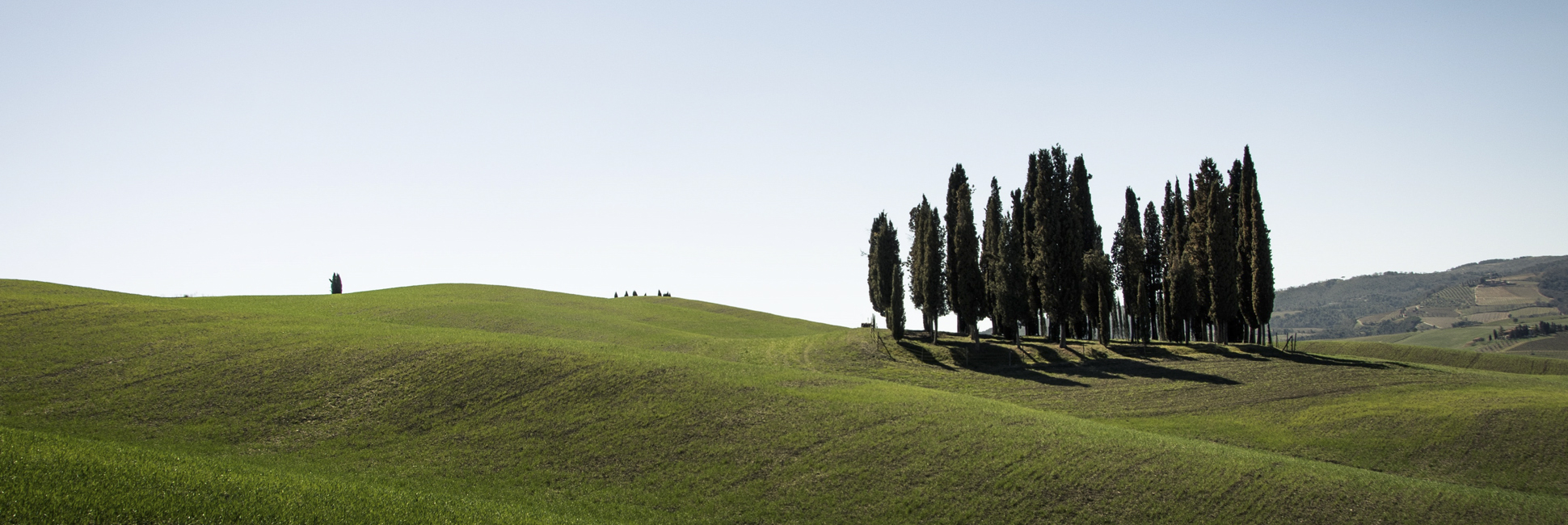
We start this itinerary from the historic center of San Quirico d’Orcia and leaving the “Porta Cappuccini” we take the paved road that leads to Pienza to turn left towards a dirt road following the signs for “Cipressi”. Continue reaching the road that leads to the Celamonti farm and turn left. Crossing the SP137 we take the path to the right that leads us to a spectacular ridge with views of both the Crete Senesi and Valdorcia. Following the path begins the descendent toward the “island of cypresses” in the middle of cultivated fields, a world famous image and symbol of the Val d’Orcia. We pass the cypresses and climb towards another circle of cypresses, which we cross to reach a ruined farmhouse and turning left we enter a dirt road that first runs alongside a small lake and then continues along the Fosso di Fonte Calda.
We follow the path and after the climb we begin to see San Quirico d’Orcia. Near the chapel of the Madonna del Riguardo we enter the Via Francigena which will lead us directly to the Collegiate Church of San Quirico, a beautiful medieval church and symbol of the village and then we return directly to the historic center of the town. ltinerary without water supply points, it is advisable to bring a larger quantity.